01 January 0001
Unveiling the captivating world of farm drone photography, this innovative technique offers an aerial shoot and aerial vantage points of agricultural landscapes using aerial technologies. From monitoring crop health to assessing irrigation systems, farm drone photography revolutionizes how farmers manage their land efficiently. By capturing high-resolution aerial images and data from above using aerial technologies, drones provide valuable insights for optimizing crop yields and detecting issues early on. This modern approach traces back to the early 2010s when drones became more accessible for commercial use, transforming the agricultural industry's practices. Embrace the power of aerial perspectives with farm drone photography to elevate your farming operations to new heights.
Key Takeaways
-
Utilize drone technology: Incorporate drones in farming for improved efficiency and decision-making.
-
Leverage aerial shots: Use drone imagery to support various farm operations and gain valuable insights.
-
Implement precision agriculture: Enhance crop and livestock management through detailed drone data analysis.
-
Utilize custom reports: Benefit from personalized reports and real-time field monitoring using drone technology.
-
Explore advanced applications: Stay updated on the latest farming practices and innovations in drone usage.
-
Consider professional services: Contact experts for drone photography services tailored to farm needs.
Benefits of Drone Use in Farming
Enhanced Monitoring
Drone farm surveying contributes significantly to enhanced crop monitoring, revolutionizing the way farmers predict yields. By utilizing drones equipped with high-resolution cameras, farmers can obtain detailed images of their crops. These images provide valuable insights into the health and growth of plants, enabling farmers to detect issues such as pests, diseases, or nutrient deficiencies early on.
Drones fly over the fields, capturing images that are then processed using specialized software to create detailed maps. These maps help farmers identify areas that require attention, allowing for targeted interventions. With this level of precision, farmers can make informed decisions regarding irrigation, fertilization, or pest control, ultimately leading to improved crop health and higher yields.
Precision Data Collection
Another key benefit of drone farm surveying is the ability to collect precise data efficiently. Drones can gather a wide range of data, including temperature, humidity, and soil conditions. This data is essential for making informed decisions about crop management practices.
By collecting data at regular intervals throughout the growing season, farmers can track changes in their fields over time. This information enables them to adjust their strategies accordingly, ensuring optimal crop growth and health. Drones can cover large areas quickly and easily, providing farmers with comprehensive data that would be challenging to obtain through traditional methods.
Increased Productivity
The integration of drones into farming practices has the potential to significantly increase overall farm productivity. By leveraging advanced technology, such as drones equipped with multispectral sensors, farmers can gain a deeper understanding of their fields. These sensors can capture data beyond what is visible to the naked eye, such as plant health indicators like chlorophyll levels.
With this advanced technology at their disposal, farmers can implement precision agriculture techniques more effectively. By tailoring their actions to specific areas within their fields based on drone-collected data, farmers can optimize resource use and maximize yields. This targeted approach not only improves productivity but also reduces waste and environmental impact.

Supporting Farm Operations with Aerial Shots
Enhanced Planning
Aerial shoot technology provides farmers with a bird's eye view of their land, aiding in planning and optimizing farm layouts. By capturing detailed images from above, farmers can identify areas that require attention, such as irrigation issues or crop health concerns. This valuable perspective helps in creating more efficient farming strategies.
Improved Infrastructure Maintenance
Utilizing an aerial camera platform, farmers can closely monitor their farm infrastructure, including buildings, fences, and equipment. By regularly capturing aerial shots, farmers can detect any damages or wear and tear early on, allowing for timely repairs and maintenance. This proactive approach ensures the longevity and functionality of essential farm structures.
Storytelling Through Imagery
Farm drone photography goes beyond practical applications; it also allows farmers to tell a visual story of their land. By documenting the seasonal changes, crop growth progress, and overall landscape beauty, farmers can create engaging content for marketing purposes or personal enjoyment. These stunning aerial images offer a unique perspective that showcases the natural beauty of farmland.
Project Monitoring and Evaluation
In addition to static images, drones can capture dynamic footage that aids in monitoring ongoing projects on the farm. Whether it's tracking the progress of a new construction or assessing the effectiveness of a crop management technique, aerial footage provides real-time insights that help farmers make informed decisions. This continuous monitoring ensures that projects stay on track and meet desired objectives.
Precision Agriculture Insights
Farm drone photography plays a crucial role in the emerging field of precision agriculture. By collecting data on soil variations, crop health indicators, and environmental conditions, drones enable farmers to make data-driven decisions for optimal yield and resource management. The detailed imagery obtained from drones enhances the accuracy of agricultural practices, leading to increased efficiency and sustainability.
Precision Agriculture through Drone Imagery
Sustainable Farming
Precision agriculture techniques revolutionize modern farming by enhancing efficiency and sustainability. Agricultural drone surveying plays a pivotal role in this process, providing farmers with valuable insights for optimal crop management.
Drones equipped with advanced sensors capture high-resolution images of farmland, enabling precise estimates of crop health and soil conditions. By analyzing this data, farmers can identify areas requiring attention, such as nutrient deficiencies or pest infestations.
-
Pros:
-
Enhances crop yield through targeted interventions.
-
Reduces environmental impact by minimizing chemical usage.
-
-
Cons:
-
Initial investment cost may be prohibitive for small-scale farmers.
-
Technical expertise required for data interpretation.
-
Soil Sampling and Analysis
Agricultural drone services offer a cutting-edge solution for accurate soil sampling and analysis. Traditional methods often involve labor-intensive processes that are time-consuming and prone to errors. In contrast, drones provide a swift and precise way to gather crucial soil data.
By collecting samples from various locations across the farm, drones enable comprehensive information gathering for soil analysis. This detailed assessment helps farmers make informed decisions regarding fertilization, pH adjustments, and other essential practices.
Optimized Irrigation Practices
Drone technology facilitates the optimization of irrigation practices through drone precision in monitoring water distribution. By capturing aerial views of the entire field, drones generate data on moisture levels and crop water requirements.
Armed with this information, farmers can tailor their irrigation schedules to meet specific crop needs accurately. This targeted approach not only conserves water but also promotes healthier plant growth and improved overall farm productivity.
-
Key Information:
-
Drones enable real-time monitoring of crop health indicators.
-
Data-driven irrigation decisions lead to resource efficiency.
-

Enhancing Crop and Livestock Management
Remote Livestock Monitoring
Livestock monitoring has been revolutionized through farm drone photography, allowing farmers to remotely track the health and behavior patterns of their animals. By utilizing drones equipped with advanced imaging technology, farmers can efficiently observe livestock grazing patterns and detect any anomalies in their behavior. This real-time monitoring helps in ensuring the well-being of the animals and enables prompt intervention in case of any issues.
Early Detection of Crop Diseases
Farm drone photography plays a crucial role in enhancing crop management by enabling early detection of diseases that may affect crops. Drones equipped with high-resolution cameras can capture detailed images of crops, allowing farmers to identify any signs of diseases or deficiencies at an early stage. This timely detection enables farmers to take necessary actions such as targeted spraying or treatment, thereby minimizing crop losses and ensuring a healthy yield.
Optimizing Feeding Schedules
One of the key aspects of livestock management is ensuring optimal nutrition for the animals. With farm drone photography, farmers can streamline feeding schedules by monitoring the availability of pasture and adjusting feeding regimes accordingly. Drones can provide valuable insights into grazing patterns, helping farmers allocate resources efficiently and ensure that animals receive adequate nutrition. This optimized feeding schedule contributes to the overall health and productivity of the livestock.
Custom Reports and Field Monitoring
Custom Reports
Farm drone photography allows for the generation of customized reports to provide detailed insights into various aspects of farm management. By capturing high-resolution images and data, drones enable farmers to analyze crop health, identify potential issues, and optimize resource allocation. These reports offer a comprehensive view of the entire farm, highlighting areas that require attention.
Utilizing drone technology, farmers can create detailed reports that include information on crop density, irrigation effectiveness, pest infestations, and overall plant health. These reports are instrumental in assessing the success of different farming practices, enabling adjustments to be made promptly to enhance productivity and yield.
Field Monitoring
Monitoring crop growth stages through drone photography is a game-changer in modern agriculture. Drones equipped with advanced imaging sensors can capture data at various wavelengths, providing valuable insights into plant development. By regularly monitoring crop progress, farmers can make informed decisions regarding irrigation, fertilization, and pest control.
Drones offer a unique advantage in tracking changes in field conditions over time. By comparing images taken at different intervals, farmers can observe trends in crop growth, detect anomalies early on, and predict potential challenges. This proactive approach to field monitoring helps optimize agricultural practices and ensures efficient resource management.
Time Data Analysis
One key benefit of using drones for field monitoring is the ability to collect time data for trend analysis. By capturing images consistently over time, drones enable farmers to track the evolution of their crops throughout the growing season. This longitudinal data provides valuable insights into the impact of various factors on crop development and helps in identifying patterns or correlations.
Analyzing time data gathered through drone photography allows farmers to make data-driven decisions based on historical trends. By understanding how crops respond to different environmental conditions over time, farmers can implement strategies to maximize yield and minimize risks. The ability to conduct trend analysis through time data enhances precision agriculture practices and supports sustainable farming methods.

Advanced Applications in Farming Practices
Pest Control
Farmers are increasingly implementing drone technology for pest control strategies. Drones equipped with high-resolution cameras can detect pest infestations early, enabling farmers to take timely action. By identifying problem areas quickly, farmers can reduce crop damage and increase yields.
Drones are also being used to monitor crops for signs of disease, allowing farmers to target specific areas with treatment. This targeted approach reduces the need for widespread pesticide application, minimizing environmental impact. Drones can be programmed to fly autonomously, covering large areas efficiently.
Precision Agriculture
In modern agriculture, drones play a crucial role in precision planting and harvesting. By integrating drones into farming practices, farmers can achieve precise seed placement and spacing. This level of accuracy ensures optimal plant growth and maximizes yield potential. Furthermore, drones equipped with specialized sensors can assess crop health and nutrient levels, enabling farmers to make data-driven decisions.
Precision agriculture also extends to harvesting operations, where drones are used to optimize the timing of harvests. Drones can survey fields and analyze crop maturity, helping farmers determine the ideal time to harvest for peak quality and yield. This targeted approach minimizes waste and ensures efficient use of resources.
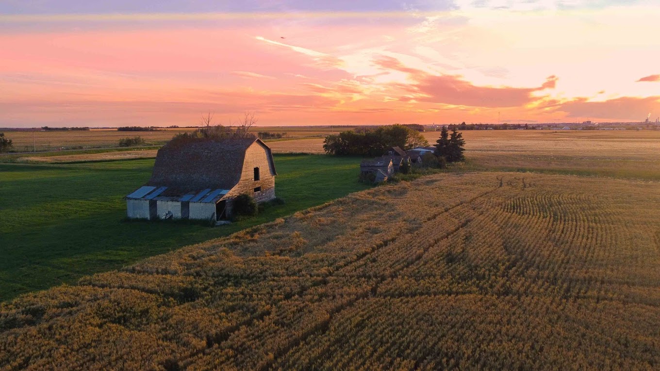
Gallery of Aerial Farm Photography
Diverse Landscapes
Aerial drone photography captures the stunning beauty of various farm landscapes, from vast fields of golden wheat to picturesque vineyards. The aerial vantage points provide a unique perspective, showcasing the intricate patterns and colors of different crops. This visual storytelling highlights the diversity of agricultural practices across regions, offering a glimpse into the rich tapestry of farming around the world.
Agricultural Practices
The aerial imagery not only showcases the scenic beauty but also serves as a valuable tool for understanding different farming techniques. By observing these photos, viewers can appreciate the precision and dedication required in modern agriculture. From precision planting to irrigation management, each image tells a story of innovation and sustainability in farming practices.
Farmers' Hard Work
Through rural farm photography services, these images celebrate the hard work and commitment of farmers. Each photograph is a testament to the labor-intensive nature of agriculture, portraying farmers as stewards of the land. The aerial footage captures moments of planting, harvesting, and tending to crops, offering a glimpse into the daily lives of those who work tirelessly to feed the world.
Contact for Drone Photography Services
Tailored Services
Reach out for aerial drone photography services designed specifically for farms. Collaborate with experts to capture the essence of farm life through stunning aerial images.
Professional Expertise
Book drone photography sessions to elevate your farm's visual appeal. Capture personalized farm imagery that showcases the beauty and functionality of your agricultural operations.
Customized Imagery
Engage with professionals in aerial drone videography to create captivating visuals of your farm. Benefit from a complete drone precision services package tailored to meet your specific needs.
Summary
In a nutshell, farm drone photography offers numerous advantages for modern agriculture. By leveraging aerial shots, you can enhance farm operations, implement precision agriculture techniques, and improve crop and livestock management. Custom reports and field monitoring further streamline your farming practices, while advanced applications push the boundaries of what's possible in the field. The gallery of aerial farm photography showcases the tangible benefits of integrating drones into your farming routine. If you're ready to elevate your farming game and embrace the future of agriculture, don't hesitate to reach out for drone photography services.
Frequently Asked Questions
What are the main benefits of using drones for farm photography?
Drones offer farmers a cost-effective way to monitor crops, livestock, and infrastructure. They provide valuable aerial insights, enhance decision-making, improve efficiency, and help in identifying issues early on.
How do aerial shots support farm operations?
Aerial shots captured by drones enable farmers to assess crop health, irrigation needs, pest infestations, and overall farm conditions quickly and accurately. This data aids in making informed decisions that optimize farming practices.
What is precision agriculture through drone imagery?
Precision agriculture involves using drone imagery to create detailed maps of farms, allowing for precise application of resources like water, fertilizers, and pesticides. This targeted approach increases yields, reduces waste, and promotes sustainability.
How does drone photography enhance crop and livestock management?
Drone photography provides farmers with real-time visual data on crop growth stages, soil conditions, and animal health. This information helps in implementing timely interventions, monitoring progress, and maximizing productivity across the farm.
Can custom reports and field monitoring be conducted through aerial shoot drone photography?
Yes, drones can generate custom reports based on aerial data collected from farms. Field monitoring through drone imagery offers insights into crop health trends, environmental factors, and operational efficiencies for informed decision-making.
Andrew Shaw Photography also offers the following services:
Real Estate Photography
Corporate Photography
Family Photography
Andrew Shaw Photography’s Top Resources Regarding Commercial Drone Photography
The Canadian Real Estate Association (CREA) and Drone Usage
Professional Photographers of Canada (PPOC)
ArchDaily – Drone Usage in Architecture